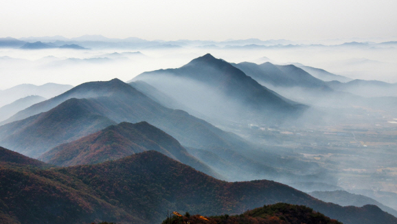
Gyeryongsan Mountain named so because the ridge between Cheonhwangbong (845m), the peak of the mountain, and Yeoncheonbong (739m) and Sambulbong (775m) summits is in the shape of a rooster comb. As one of the relatively more rugged mountains of the Charyeongsan Mountain Range, Gyeryongsan Mountain features unique terrains and landscape that blend beautifully with the exquisite scenery of the Geumgang River. It is considered one of the top four mountains according to Pungsujiri, or the principles of geomancy, and it welcomes endless streams of visitors with its breathtaking scenery.
327-6, Donghaksa 1-ro, Banpo-myeon, Gongju-si, Chungcheongnam-do

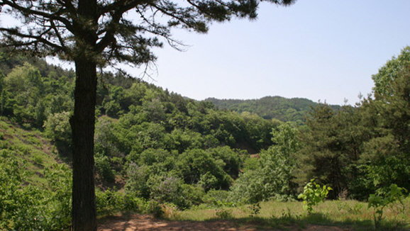
Taehwasan Mountain situated in Sagok-myeon, Gongju-si is well-known for Magoksa Temple, a thousand-year-old temple nestled in the hillsides. Countless hikers and mountain climbers visit the mountain to check out the dense red pine forest and appreciate the beautiful temple grounds. The entire area is covered with pines, so visitors can enjoy a therapeutic walk in the woods. Yugu Magok Valley, in particular, has been recorded in geographical books such as Taengniji and Jeonggamnok as a place that can avoid war and conflict.
32-87, Saenggol-gil, Sagok-myeon, Gongju-si, Chungcheongnam-do
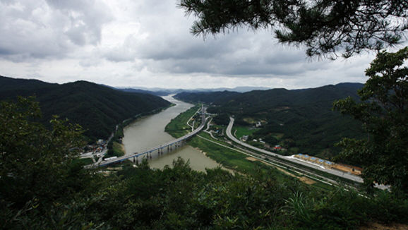
Changbyeoksan Mountain is located on the riverside of Geumgang in Maam-ri, Banpo-myeon, Gongju. Changbyeok Cliff was created by a northern extension of the ridge from Gyeryongsan, considered a sacred mountain by the Korean people, toward the Geumgang River. The scenic landscape of the massive rocky cliff, standing 25m tall and 100m wide, and the Geumgang River flowing below have attracted countless poets and writers for years. On Changbyeoksan Mountain (277m), one can enjoy a splendid view of the Geumgang River replenishing the area with water before winding toward the south to drench the heart of Gongju.
San 4-4, Maam-ri, Banpo-myeon, Gongju-si, Chungcheongnam-do
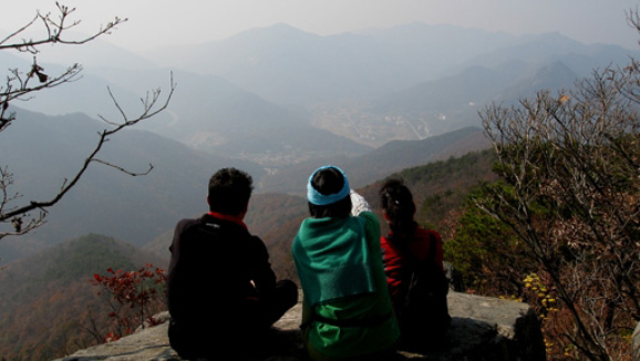
Standing 314m, Wolseongsan Mountain is also known as Bongujae. It is situated southeast of the city center, and it stands relatively tall in the west-east direction. Together with Duribong Peak (Mawolsan Mountain) and Jumisan Mountain, it surrounds Gongju in the shape of a gigantic ship. Considered the “guardian mountain” of Gongju, Wolseongsan Mountain contains a beacon mound that played a key role in communication between the people of Seoul and the southern region in the Joseon Dynasty. The beacon mound constructed in the Joseon Dynasty was critical in communicating with Seoul by receiving the signal fire received from the Jeolla-do area and passing it down the beacon mound on Godeungsan Mountain in Jeongan-myeon.
149-21, Singidong-gil, Gongju-si, Chungcheongnam-do
This mountain range includes Wolseongsan Mountain (Bonghwadae Beacon Mound), Jumisan Mountain and Duribong Peak of Mangwolsan, which surround Gongju in the shape of a massive ship. Hikers can relax in a pavilion below Bonghwadae Beacon Mound and Duribong Peak, and 150m below the pavilion, there is a spring providing iron-rich water that quenches people’s thirst.
Check the starting location of each route
 국가상징
국가상징